Using Augmented Reality to Visualize how Block-Size and Block-Shape Influences Rockfall Trajectories
Background
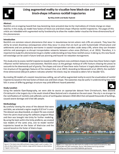
Using Unity and Vuforia AR Engine we were able to create rockfall simulations varying in rock shape and size in augmented reality (AR). Each journal page, (viewable below), contains elements that allow real-time camera tracking in order to display the AR simulation. The topography model was created from LiDAR imagery of a real cliffside in Christchurch, New Zealand. Action buttons on the screen trigger the respective size or shape of rocks present in the fall. Based on the simulations, large irregular rocks as opposed to smaller square and spherical rocks, are more likely to travel further posing the greatest risk.
This project was completed by Riley Smith and Nadia Tepleski in Spring 2019 for GEOG 457 Geovisualization Interfaces at SFU, with assistance from Ian Lochhead and Dr. Nick Hedley.